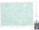
Maps showing Seguin River Conservation Reserve, Parry Sound, Ontario
Seguin River Conservation Reserve is a Conservation area located in Parry Sound, Ontario.
- Latitude: 45° 24' 6'' North (decimal: 45.4016668)
- Longitude: 79° 58' 22'' West (decimal: -79.9727778)
- Topography Feature Category: Conservation area
- Geographical Feature: Conservation Reserve
- Canadian Province/Territory: Ontario
- Location: Parry Sound
- Atlas of Canada Locator Map: Seguin River Conservation Reserve
- GPS Coordinate Locator Map: Seguin River Conservation Reserve Lat/Long
Seguin River Conservation Reserve NTS Map Sheets