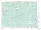
Maps showing Commanda Creek Conservation Reserve, Parry Sound, Ontario
Commanda Creek Conservation Reserve is a Conservation area located in Parry Sound, Ontario.
- Latitude: 45° 51' 45'' North (decimal: 45.8625000)
- Longitude: 79° 34' 0'' West (decimal: -79.5667000)
- Topography Feature Category: Conservation area
- Geographical Feature: Conservation Reserve
- Canadian Province/Territory: Ontario
- Location: Parry Sound
- Atlas of Canada Locator Map: Commanda Creek Conservation Reserve
- GPS Coordinate Locator Map: Commanda Creek Conservation Reserve Lat/Long
Commanda Creek Conservation Reserve NTS Map Sheets