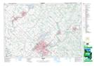
Maps showing Horst Creek, WATERLOO, Ontario
Horst Creek is a River located in WATERLOO, Ontario.
- Latitude: 43° 30' 59'' North (decimal: 43.5164009)
- Longitude: 80° 28' 47'' West (decimal: -80.4797438)
- Topography Feature Category: River
- Geographical Feature: Creek
- Canadian Province/Territory: Ontario
- Location: WATERLOO
- Atlas of Canada Locator Map: Horst Creek
- GPS Coordinate Locator Map: Horst Creek Lat/Long