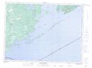
Maps showing Le Pate Provincial Nature Reserve, Ontario
Le Pate Provincial Nature Reserve is a Conservation area located in Ontario.
- Latitude: 48° 13' 57'' North (decimal: 48.23261)
- Longitude: 89° 9' 26'' West (decimal: -89.15721)
- Topography Feature Category: Conservation area
- Geographical Feature: Provincial Nature Reserve
- Canadian Province/Territory: Ontario
- Atlas of Canada Locator Map: Le Pate Provincial Nature Reserve
- GPS Coordinate Locator Map: Le Pate Provincial Nature Reserve Lat/Long
Le Pate Provincial Nature Reserve NTS Map Sheets