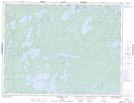
Maps showing Eagle-Dogtooth Provincial Park, Ontario
Eagle-Dogtooth Provincial Park is a Conservation area located in Ontario.
- Latitude: 49° 44' 14'' North (decimal: 49.737221)
- Longitude: 93° 42' 21'' West (decimal: -93.705703)
- Topography Feature Category: Conservation area
- Geographical Feature: Provincial Park
- Canadian Province/Territory: Ontario
- Atlas of Canada Locator Map: Eagle-Dogtooth Provincial Park
- GPS Coordinate Locator Map: Eagle-Dogtooth Provincial Park Lat/Long
Eagle-Dogtooth Provincial Park NTS Map Sheets