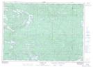
Maps showing River Aux Sables Provincial Park, Mandamin, Ontario
River Aux Sables Provincial Park is a Conservation area located in Mandamin, Ontario.
- Latitude: 46° 27' 11'' North (decimal: 46.453097)
- Longitude: 82° 10' 48'' West (decimal: -82.179973)
- Topography Feature Category: Conservation area
- Geographical Feature: Provincial Park
- Canadian Province/Territory: Ontario
- Location: Mandamin
- Atlas of Canada Locator Map: River Aux Sables Provincial Park
- GPS Coordinate Locator Map: River Aux Sables Provincial Park Lat/Long
River Aux Sables Provincial Park NTS Map Sheets