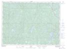
Maps showing Rushbrook Provincial Park, Ouellette, Ontario
Rushbrook Provincial Park is a Conservation area located in Ouellette, Ontario.
- Latitude: 46° 43' 47'' North (decimal: 46.72978)
- Longitude: 81° 56' 40'' West (decimal: -81.9443918)
- Topography Feature Category: Conservation area
- Geographical Feature: Provincial Park
- Canadian Province/Territory: Ontario
- Location: Ouellette
- Atlas of Canada Locator Map: Rushbrook Provincial Park
- GPS Coordinate Locator Map: Rushbrook Provincial Park Lat/Long