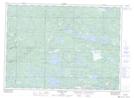
Maps showing Blind River Provincial Park, Jogues, Ontario
Blind River Provincial Park is a Conservation area located in Jogues, Ontario.
- Latitude: 46° 30' 25'' North (decimal: 46.50681)
- Longitude: 82° 55' 56'' West (decimal: -82.932271)
- Topography Feature Category: Conservation area
- Geographical Feature: Provincial Park
- Canadian Province/Territory: Ontario
- Location: Jogues
- Atlas of Canada Locator Map: Blind River Provincial Park
- GPS Coordinate Locator Map: Blind River Provincial Park Lat/Long
Blind River Provincial Park NTS Map Sheets