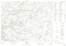
Maps showing Tide Lake Provincial Nature Reserve, Kenora, Ontario
Tide Lake Provincial Nature Reserve is a Conservation area located in Kenora, Ontario.
- Latitude: 50° 19' 10'' North (decimal: 50.319564)
- Longitude: 93° 59' 39'' West (decimal: -93.994071)
- Topography Feature Category: Conservation area
- Geographical Feature: Provincial Nature Reserve
- Canadian Province/Territory: Ontario
- Location: Kenora
- Atlas of Canada Locator Map: Tide Lake Provincial Nature Reserve
- GPS Coordinate Locator Map: Tide Lake Provincial Nature Reserve Lat/Long