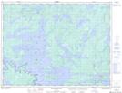
Maps showing Brown's Inlet Conservation Reserve, Griesinger, Ontario
Brown's Inlet Conservation Reserve is a Conservation area located in Griesinger, Ontario.
- Latitude: 48° 47' 13'' North (decimal: 48.786997)
- Longitude: 93° 24' 31'' West (decimal: -93.408658)
- Topography Feature Category: Conservation area
- Geographical Feature: Conservation Reserve
- Canadian Province/Territory: Ontario
- Location: Griesinger
- Atlas of Canada Locator Map: Brown's Inlet Conservation Reserve
- GPS Coordinate Locator Map: Brown's Inlet Conservation Reserve Lat/Long
Brown's Inlet Conservation Reserve NTS Map Sheets