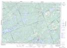
Maps showing Hungry Lake Conservation Reserve, Olden, Ontario
Hungry Lake Conservation Reserve is a Conservation area located in Olden, Ontario.
- Latitude: 44° 49' 29'' North (decimal: 44.824709)
- Longitude: 76° 53' 51'' West (decimal: -76.897467)
- Topography Feature Category: Conservation area
- Geographical Feature: Conservation Reserve
- Canadian Province/Territory: Ontario
- Location: Olden
- Atlas of Canada Locator Map: Hungry Lake Conservation Reserve
- GPS Coordinate Locator Map: Hungry Lake Conservation Reserve Lat/Long
Hungry Lake Conservation Reserve NTS Map Sheets