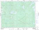
Maps showing Melgund Lake Conservation Reserve, Avery, Ontario
Melgund Lake Conservation Reserve is a Conservation area located in Avery, Ontario.
- Latitude: 49° 39' 6'' North (decimal: 49.651736)
- Longitude: 92° 19' 49'' West (decimal: -92.330345)
- Topography Feature Category: Conservation area
- Geographical Feature: Conservation Reserve
- Canadian Province/Territory: Ontario
- Location: Avery
- Atlas of Canada Locator Map: Melgund Lake Conservation Reserve
- GPS Coordinate Locator Map: Melgund Lake Conservation Reserve Lat/Long