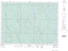
Maps showing Onaping Lake Conservation Reserve, Onaping, Ontario
Onaping Lake Conservation Reserve is a Conservation area located in Onaping, Ontario.
- Latitude: 47° 4' 00'' North (decimal: 47.066593)
- Longitude: 81° 30' 14'' West (decimal: -81.5039538)
- Topography Feature Category: Conservation area
- Geographical Feature: Conservation Reserve
- Canadian Province/Territory: Ontario
- Location: Onaping
- Atlas of Canada Locator Map: Onaping Lake Conservation Reserve
- GPS Coordinate Locator Map: Onaping Lake Conservation Reserve Lat/Long
Onaping Lake Conservation Reserve NTS Map Sheets