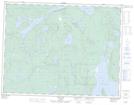
Maps showing Ottertooth Conservation Reserve, Ontario
Ottertooth Conservation Reserve is a Conservation area located in Ontario.
- Latitude: 49° 48' 15'' North (decimal: 49.804242)
- Longitude: 89° 24' 47'' West (decimal: -89.413166)
- Topography Feature Category: Conservation area
- Geographical Feature: Conservation Reserve
- Canadian Province/Territory: Ontario
- Atlas of Canada Locator Map: Ottertooth Conservation Reserve
- GPS Coordinate Locator Map: Ottertooth Conservation Reserve Lat/Long