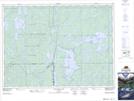
Maps showing Sugar Lake Conservation Reserve, Dane, Ontario
Sugar Lake Conservation Reserve is a Conservation area located in Dane, Ontario.
- Latitude: 47° 20' 57'' North (decimal: 47.349195)
- Longitude: 80° 7' 14'' West (decimal: -80.120587)
- Topography Feature Category: Conservation area
- Geographical Feature: Conservation Reserve
- Canadian Province/Territory: Ontario
- Location: Dane
- Atlas of Canada Locator Map: Sugar Lake Conservation Reserve
- GPS Coordinate Locator Map: Sugar Lake Conservation Reserve Lat/Long
Sugar Lake Conservation Reserve NTS Map Sheets