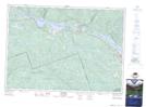
Maps showing Heney Creek, Head, Ontario
Heney Creek is a River located in Head, Ontario.
- Latitude: 46° 11' 26'' North (decimal: 46.190672)
- Longitude: 77° 51' 54'' West (decimal: -77.864928)
- Topography Feature Category: River
- Geographical Feature: Creek
- Canadian Province/Territory: Ontario
- Location: Head
- Atlas of Canada Locator Map: Heney Creek
- GPS Coordinate Locator Map: Heney Creek Lat/Long
Heney Creek NTS Map Sheets