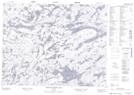
Maps showing Upper Hatchet Lake, Kenora, Ontario
Upper Hatchet Lake is a Lake located in Kenora, Ontario.
- Latitude: 50° 57' 50'' North (decimal: 50.9638888)
- Longitude: 94° 19' 55'' West (decimal: -94.3319443)
- Topography Feature Category: Lake
- Geographical Feature: Lake
- Canadian Province/Territory: Ontario
- Location: Kenora
- Atlas of Canada Locator Map: Upper Hatchet Lake
- GPS Coordinate Locator Map: Upper Hatchet Lake Lat/Long
Upper Hatchet Lake NTS Map Sheets