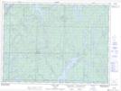
Maps showing Smithette Lake, Sudbury, Ontario
Smithette Lake is a Lake located in Sudbury, Ontario.
- Latitude: 47° 50' 10'' North (decimal: 47.8361111)
- Longitude: 82° 13' 5'' West (decimal: -82.2180555)
- Topography Feature Category: Lake
- Geographical Feature: Lake
- Canadian Province/Territory: Ontario
- Location: Sudbury
- Atlas of Canada Locator Map: Smithette Lake
- GPS Coordinate Locator Map: Smithette Lake Lat/Long