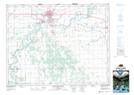
Maps showing Portage Spillway Provincial Wayside Park, Manitoba
Portage Spillway Provincial Wayside Park is a Conservation area located in Manitoba and has an elevation of 260 meters.
- Latitude: 49° 56' 56'' North (decimal: 49.9488999)
- Longitude: 98° 19' 44'' West (decimal: -98.3288999)
- Topography Feature Category: Conservation area
- Geographical Feature: Provincial Wayside Park
- Canadian Province/Territory: Manitoba
- Elevation: 260 meters
- Atlas of Canada Locator Map: Portage Spillway Provincial Wayside Park
- GPS Coordinate Locator Map: Portage Spillway Provincial Wayside Park Lat/Long
Portage Spillway Provincial Wayside Park NTS Map Sheets