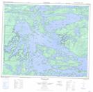
Maps showing Booth Island, 56-19-E, Manitoba
Booth Island is a Island located in 56-19-E, Manitoba.
- Latitude: 53° 51' 40'' North (decimal: 53.8610999)
- Longitude: 94° 39' 2'' West (decimal: -94.6505999)
- Topography Feature Category: Island
- Geographical Feature: Island
- Canadian Province/Territory: Manitoba
- Location: 56-19-E
- Atlas of Canada Locator Map: Booth Island
- GPS Coordinate Locator Map: Booth Island Lat/Long
Booth Island NTS Map Sheets