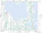
Maps showing Aimes Point, 29,30-30-16-W, Manitoba
Aimes Point is a Cape located in 29,30-30-16-W, Manitoba and has an elevation of 265 meters.
- Latitude: 51° 36' 14'' North (decimal: 51.6039000)
- Longitude: 99° 41' 29'' West (decimal: -99.6914000)
- Topography Feature Category: Cape
- Geographical Feature: Point
- Canadian Province/Territory: Manitoba
- Elevation: 265 meters
- Location: 29,30-30-16-W
- Atlas of Canada Locator Map: Aimes Point
- GPS Coordinate Locator Map: Aimes Point Lat/Long
Aimes Point NTS Map Sheets