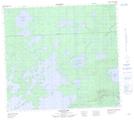
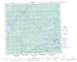
Maps showing Akinokumak Lake, Manitoba
Akinokumak Lake is a Lake located in Manitoba.
- Latitude: 56° 42' 17'' North (decimal: 56.7046999)
- Longitude: 96° 9' 29'' West (decimal: -96.1580999)
- Topography Feature Category: Lake
- Geographical Feature: Lake
- Canadian Province/Territory: Manitoba
- Atlas of Canada Locator Map: Akinokumak Lake
- GPS Coordinate Locator Map: Akinokumak Lake Lat/Long
Akinokumak Lake NTS Map Sheets