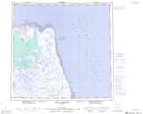
Maps showing Alapapoo Bay, Manitoba
Alapapoo Bay is a Bay located in Manitoba.
- Latitude: 58° 2' 15'' North (decimal: 58.0374999)
- Longitude: 92° 48' 11'' West (decimal: -92.8031000)
- Topography Feature Category: Bay
- Geographical Feature: Bay
- Canadian Province/Territory: Manitoba
- Atlas of Canada Locator Map: Alapapoo Bay
- GPS Coordinate Locator Map: Alapapoo Bay Lat/Long
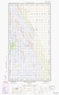
Alapapoo Bay NTS Map Sheets