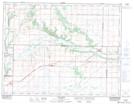
Maps showing Alexander Bridge, 4-11-21-W, Manitoba
Alexander Bridge is a Road feature located in 4-11-21-W, Manitoba and has an elevation of 359 meters.
- Latitude: 49° 53' 55'' North (decimal: 49.8985999)
- Longitude: 100° 18' 3'' West (decimal: -100.3008000)
- Topography Feature Category: Road feature
- Geographical Feature: Bridge
- Canadian Province/Territory: Manitoba
- Elevation: 359 meters
- Location: 4-11-21-W
- Atlas of Canada Locator Map: Alexander Bridge
- GPS Coordinate Locator Map: Alexander Bridge Lat/Long