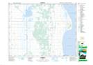
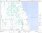
Maps showing Alonsa Drain, 17-11-W, Manitoba
Alonsa Drain is a Hydraulic construction located in 17-11-W, Manitoba and has an elevation of 267 meters.
- Latitude: 50° 26' 57'' North (decimal: 50.4491999)
- Longitude: 98° 52' 10'' West (decimal: -98.8694000)
- Topography Feature Category: Hydraulic construction
- Geographical Feature: Drain
- Canadian Province/Territory: Manitoba
- Elevation: 267 meters
- Location: 17-11-W
- Atlas of Canada Locator Map: Alonsa Drain
- GPS Coordinate Locator Map: Alonsa Drain Lat/Long
Alonsa Drain NTS Map Sheets