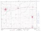
Maps showing Altbergthal, 1-2-2-W, Manitoba
Altbergthal is a Unincorporated area located in 1-2-2-W, Manitoba and has an elevation of 250 meters.
- Latitude: 49° 5' 30'' North (decimal: 49.0917000)
- Longitude: 97° 36' 35'' West (decimal: -97.6096999)
- Topography Feature Category: Unincorporated area
- Geographical Feature: Community
- Canadian Province/Territory: Manitoba
- Elevation: 250 meters
- Location: 1-2-2-W
- Atlas of Canada Locator Map: Altbergthal
- GPS Coordinate Locator Map: Altbergthal Lat/Long