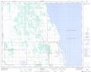
Maps showing Amaranth, 1-19-10-W, Manitoba
Amaranth is a Unincorporated area located in 1-19-10-W, Manitoba and has an elevation of 269 meters.
- Latitude: 50° 35' 44'' North (decimal: 50.5956000)
- Longitude: 98° 44' 18'' West (decimal: -98.7382999)
- Topography Feature Category: Unincorporated area
- Geographical Feature: Local Urban District
- Canadian Province/Territory: Manitoba
- Elevation: 269 meters
- Location: 1-19-10-W
- Atlas of Canada Locator Map: Amaranth
- GPS Coordinate Locator Map: Amaranth Lat/Long