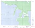
Maps showing Ami Bay, 45,46-16,17-W, Manitoba
Ami Bay is a Bay located in 45,46-16,17-W, Manitoba.
- Latitude: 52° 56' 42'' North (decimal: 52.9450000)
- Longitude: 99° 47' 7'' West (decimal: -99.7853000)
- Topography Feature Category: Bay
- Geographical Feature: Bay
- Canadian Province/Territory: Manitoba
- Location: 45,46-16,17-W
- Atlas of Canada Locator Map: Ami Bay
- GPS Coordinate Locator Map: Ami Bay Lat/Long
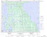
Ami Bay NTS Map Sheets