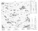
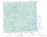
Maps showing Aministikowasik Lake, Manitoba
Aministikowasik Lake is a Lake located in Manitoba and has an elevation of 236 meters.
- Latitude: 56° 31' 41'' North (decimal: 56.5280999)
- Longitude: 96° 48' 40'' West (decimal: -96.8111000)
- Topography Feature Category: Lake
- Geographical Feature: Lake
- Canadian Province/Territory: Manitoba
- Elevation: 236 meters
- Atlas of Canada Locator Map: Aministikowasik Lake
- GPS Coordinate Locator Map: Aministikowasik Lake Lat/Long
Aministikowasik Lake NTS Map Sheets