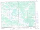
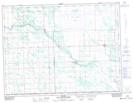
Maps showing Arbakka Drain, 11-1-7-E, Manitoba
Arbakka Drain is a Hydraulic construction located in 11-1-7-E, Manitoba and has an elevation of 305 meters.
- Latitude: 49° 1' 42'' North (decimal: 49.0282999)
- Longitude: 96° 31' 32'' West (decimal: -96.5256000)
- Topography Feature Category: Hydraulic construction
- Geographical Feature: Drain
- Canadian Province/Territory: Manitoba
- Elevation: 305 meters
- Location: 11-1-7-E
- Atlas of Canada Locator Map: Arbakka Drain
- GPS Coordinate Locator Map: Arbakka Drain Lat/Long
Arbakka Drain NTS Map Sheets