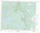
Maps showing Arch Lake, 23-41-28-W, Manitoba
Arch Lake is a Lake located in 23-41-28-W, Manitoba and has an elevation of 739 meters.
- Latitude: 52° 32' 39'' North (decimal: 52.5441999)
- Longitude: 101° 23' 24'' West (decimal: -101.3899999)
- Topography Feature Category: Lake
- Geographical Feature: Lake
- Canadian Province/Territory: Manitoba
- Elevation: 739 meters
- Location: 23-41-28-W
- Atlas of Canada Locator Map: Arch Lake
- GPS Coordinate Locator Map: Arch Lake Lat/Long