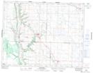
Maps showing Armstrong Creek, 2-18-29-W, Manitoba
Armstrong Creek is a River located in 2-18-29-W, Manitoba and has an elevation of 469 meters.
- Latitude: 50° 30' 58'' North (decimal: 50.5161000)
- Longitude: 101° 22' 33'' West (decimal: -101.3758000)
- Topography Feature Category: River
- Geographical Feature: Creek
- Canadian Province/Territory: Manitoba
- Elevation: 469 meters
- Location: 2-18-29-W
- Atlas of Canada Locator Map: Armstrong Creek
- GPS Coordinate Locator Map: Armstrong Creek Lat/Long
Armstrong Creek NTS Map Sheets