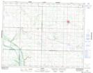
Maps showing Arrow River Marshes, 15,21-14-26-W, Manitoba
Arrow River Marshes is a Low vegetation located in 15,21-14-26-W, Manitoba and has an elevation of 472 meters.
- Latitude: 50° 11' 56'' North (decimal: 50.1988999)
- Longitude: 100° 58' 8'' West (decimal: -100.9688999)
- Topography Feature Category: Low vegetation
- Geographical Feature: Marshes
- Canadian Province/Territory: Manitoba
- Elevation: 472 meters
- Location: 15,21-14-26-W
- Atlas of Canada Locator Map: Arrow River Marshes
- GPS Coordinate Locator Map: Arrow River Marshes Lat/Long
Arrow River Marshes NTS Map Sheets