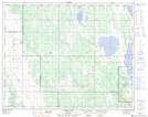
Maps showing Asham Point, 12-26-12-W, Manitoba
Asham Point is a Unincorporated area located in 12-26-12-W, Manitoba and has an elevation of 268 meters.
- Latitude: 51° 13' 46'' North (decimal: 51.2293999)
- Longitude: 99° 2' 54'' West (decimal: -99.0482999)
- Topography Feature Category: Unincorporated area
- Geographical Feature: Locality
- Canadian Province/Territory: Manitoba
- Elevation: 268 meters
- Location: 12-26-12-W
- Atlas of Canada Locator Map: Asham Point
- GPS Coordinate Locator Map: Asham Point Lat/Long
Asham Point NTS Map Sheets