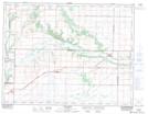
Maps showing Ashbury, 3-10-22-W, Manitoba
Ashbury is a Unincorporated area located in 3-10-22-W, Manitoba and has an elevation of 427 meters.
- Latitude: 49° 48' 14'' North (decimal: 49.8038999)
- Longitude: 100° 23' 21'' West (decimal: -100.3891999)
- Topography Feature Category: Unincorporated area
- Geographical Feature: Railway Point
- Canadian Province/Territory: Manitoba
- Elevation: 427 meters
- Location: 3-10-22-W
- Atlas of Canada Locator Map: Ashbury
- GPS Coordinate Locator Map: Ashbury Lat/Long