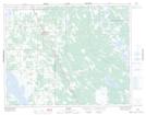
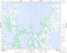
Maps showing Ashern Drain, 28-25-8-W, Manitoba
Ashern Drain is a Hydraulic construction located in 28-25-8-W, Manitoba and has an elevation of 274 meters.
- Latitude: 51° 11' 23'' North (decimal: 51.1896999)
- Longitude: 98° 31' 47'' West (decimal: -98.5296999)
- Topography Feature Category: Hydraulic construction
- Geographical Feature: Drain
- Canadian Province/Territory: Manitoba
- Elevation: 274 meters
- Location: 28-25-8-W
- Atlas of Canada Locator Map: Ashern Drain
- GPS Coordinate Locator Map: Ashern Drain Lat/Long
Ashern Drain NTS Map Sheets