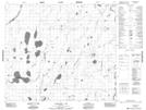
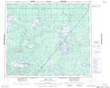
Maps showing Atikamaykus Lake, Manitoba
Atikamaykus Lake is a Lake located in Manitoba and has an elevation of 179 meters.
- Latitude: 54° 48' 27'' North (decimal: 54.8075000)
- Longitude: 92° 55' 36'' West (decimal: -92.9267000)
- Topography Feature Category: Lake
- Geographical Feature: Lake
- Canadian Province/Territory: Manitoba
- Elevation: 179 meters
- Atlas of Canada Locator Map: Atikamaykus Lake
- GPS Coordinate Locator Map: Atikamaykus Lake Lat/Long
Atikamaykus Lake NTS Map Sheets