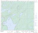
Maps showing Atkins Lake, 67-14,15-W, Manitoba
Atkins Lake is a Lake located in 67-14,15-W, Manitoba and has an elevation of 275 meters.
- Latitude: 54° 49' 24'' North (decimal: 54.8232999)
- Longitude: 99° 36' 4'' West (decimal: -99.6010999)
- Topography Feature Category: Lake
- Geographical Feature: Lake
- Canadian Province/Territory: Manitoba
- Elevation: 275 meters
- Location: 67-14,15-W
- Atlas of Canada Locator Map: Atkins Lake
- GPS Coordinate Locator Map: Atkins Lake Lat/Long
Atkins Lake NTS Map Sheets