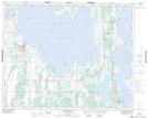
Maps showing Bachelors Island Reef, 32-18-W, Manitoba
Bachelors Island Reef is a Shoal located in 32-18-W, Manitoba and has an elevation of 265 meters.
- Latitude: 51° 42' 57'' North (decimal: 51.7157999)
- Longitude: 99° 54' 10'' West (decimal: -99.9028000)
- Topography Feature Category: Shoal
- Geographical Feature: Reef
- Canadian Province/Territory: Manitoba
- Elevation: 265 meters
- Location: 32-18-W
- Atlas of Canada Locator Map: Bachelors Island Reef
- GPS Coordinate Locator Map: Bachelors Island Reef Lat/Long
Bachelors Island Reef NTS Map Sheets