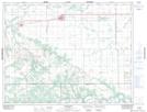
Maps showing Bagot Creek, 12-11-9-W, Manitoba
Bagot Creek is a River located in 12-11-9-W, Manitoba and has an elevation of 279 meters.
- Latitude: 49° 54' 59'' North (decimal: 49.9164000)
- Longitude: 98° 33' 41'' West (decimal: -98.5614000)
- Topography Feature Category: River
- Geographical Feature: Creek
- Canadian Province/Territory: Manitoba
- Elevation: 279 meters
- Location: 12-11-9-W
- Atlas of Canada Locator Map: Bagot Creek
- GPS Coordinate Locator Map: Bagot Creek Lat/Long