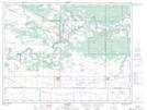
Maps showing Bald Head Hills, 8-14-W, Manitoba
Bald Head Hills is a Mountain located in 8-14-W, Manitoba and has an elevation of 366 meters.
- Latitude: 49° 40' 52'' North (decimal: 49.6810999)
- Longitude: 99° 18' 18'' West (decimal: -99.3050000)
- Topography Feature Category: Mountain
- Geographical Feature: Hills
- Canadian Province/Territory: Manitoba
- Elevation: 366 meters
- Location: 8-14-W
- Atlas of Canada Locator Map: Bald Head Hills
- GPS Coordinate Locator Map: Bald Head Hills Lat/Long