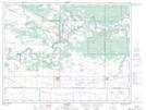
Maps showing Barr Sloughs, 14-7-15-W, Manitoba
Barr Sloughs is a Low vegetation located in 14-7-15-W, Manitoba and has an elevation of 373 meters.
- Latitude: 49° 34' 30'' North (decimal: 49.5749999)
- Longitude: 99° 16' 6'' West (decimal: -99.2683000)
- Topography Feature Category: Low vegetation
- Geographical Feature: Sloughs
- Canadian Province/Territory: Manitoba
- Elevation: 373 meters
- Location: 14-7-15-W
- Atlas of Canada Locator Map: Barr Sloughs
- GPS Coordinate Locator Map: Barr Sloughs Lat/Long