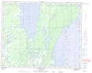
Maps showing Base Line Point, 41-18-W, Manitoba
Base Line Point is a Cape located in 41-18-W, Manitoba and has an elevation of 271 meters.
- Latitude: 52° 29' 39'' North (decimal: 52.4942000)
- Longitude: 100° 0' 15'' West (decimal: -100.0042000)
- Topography Feature Category: Cape
- Geographical Feature: Point
- Canadian Province/Territory: Manitoba
- Elevation: 271 meters
- Location: 41-18-W
- Atlas of Canada Locator Map: Base Line Point
- GPS Coordinate Locator Map: Base Line Point Lat/Long
Base Line Point NTS Map Sheets