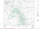
Maps showing Bear Cat Creek, 9-14-13-W, Manitoba
Bear Cat Creek is a River located in 9-14-13-W, Manitoba.
- Latitude: 50° 10' 36'' North (decimal: 50.1766999)
- Longitude: 99° 10' 53'' West (decimal: -99.1814000)
- Topography Feature Category: River
- Geographical Feature: Creek
- Canadian Province/Territory: Manitoba
- Location: 9-14-13-W
- Atlas of Canada Locator Map: Bear Cat Creek
- GPS Coordinate Locator Map: Bear Cat Creek Lat/Long