Maps showing Bedford, 9-5-9-E, Manitoba
Bedford is a Unincorporated area located in 9-5-9-E, Manitoba and has an elevation of 339 meters.
- Latitude: 49° 22' 21'' North (decimal: 49.3725000)
- Longitude: 96° 19' 18'' West (decimal: -96.3217000)
- Topography Feature Category: Unincorporated area
- Geographical Feature: Railway Point
- Canadian Province/Territory: Manitoba
- Elevation: 339 meters
- Location: 9-5-9-E
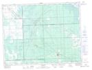
- Atlas of Canada Locator Map: Bedford
- GPS Coordinate Locator Map: Bedford Lat/Long