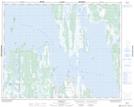
Maps showing Bergs Island, 31-15-W, Manitoba
Bergs Island is a Island located in 31-15-W, Manitoba and has an elevation of 255 meters.
- Latitude: 51° 38' 39'' North (decimal: 51.6442000)
- Longitude: 99° 27' 4'' West (decimal: -99.4511000)
- Topography Feature Category: Island
- Geographical Feature: Island
- Canadian Province/Territory: Manitoba
- Elevation: 255 meters
- Location: 31-15-W
- Atlas of Canada Locator Map: Bergs Island
- GPS Coordinate Locator Map: Bergs Island Lat/Long
Bergs Island NTS Map Sheets