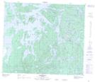
Maps showing Bess Creek, 36-70-25-W, Manitoba
Bess Creek is a River located in 36-70-25-W, Manitoba and has an elevation of 333 meters.
- Latitude: 55° 6' 35'' North (decimal: 55.1097000)
- Longitude: 101° 7' 35'' West (decimal: -101.1263999)
- Topography Feature Category: River
- Geographical Feature: Creek
- Canadian Province/Territory: Manitoba
- Elevation: 333 meters
- Location: 36-70-25-W
- Atlas of Canada Locator Map: Bess Creek
- GPS Coordinate Locator Map: Bess Creek Lat/Long
Bess Creek NTS Map Sheets