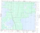
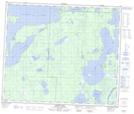
Maps showing Big Bend, 25,26-58-28-W, Manitoba
Big Bend is a River feature located in 25,26-58-28-W, Manitoba and has an elevation of 275 meters.
- Latitude: 54° 2' 35'' North (decimal: 54.0430999)
- Longitude: 101° 30' 00'' West (decimal: -101.4999999)
- Topography Feature Category: River feature
- Geographical Feature: Bend
- Canadian Province/Territory: Manitoba
- Elevation: 275 meters
- Location: 25,26-58-28-W
- Atlas of Canada Locator Map: Big Bend
- GPS Coordinate Locator Map: Big Bend Lat/Long
Big Bend NTS Map Sheets