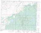
Maps showing Big Bud Lake, 22,23-32-28-W, Manitoba
Big Bud Lake is a Lake located in 22,23-32-28-W, Manitoba and has an elevation of 668 meters.
- Latitude: 51° 45' 20'' North (decimal: 51.7556000)
- Longitude: 101° 20' 19'' West (decimal: -101.3385999)
- Topography Feature Category: Lake
- Geographical Feature: Lake
- Canadian Province/Territory: Manitoba
- Elevation: 668 meters
- Location: 22,23-32-28-W
- Atlas of Canada Locator Map: Big Bud Lake
- GPS Coordinate Locator Map: Big Bud Lake Lat/Long
Big Bud Lake NTS Map Sheets