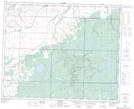
Maps showing Big Fuller Lake, 2-34-27-W, Manitoba
Big Fuller Lake is a Lake located in 2-34-27-W, Manitoba and has an elevation of 598 meters.
- Latitude: 51° 53' 21'' North (decimal: 51.8891999)
- Longitude: 101° 11' 00'' West (decimal: -101.1833000)
- Topography Feature Category: Lake
- Geographical Feature: Lake
- Canadian Province/Territory: Manitoba
- Elevation: 598 meters
- Location: 2-34-27-W
- Atlas of Canada Locator Map: Big Fuller Lake
- GPS Coordinate Locator Map: Big Fuller Lake Lat/Long
Big Fuller Lake NTS Map Sheets